
Significant State Activity Other Immediate Concerns ●New The most significant rises are currently forecast for the Lower Weber River at Plain City, the Little Bear at Paradise, and East Canyon Creek near Jeremy Ranch downstream to East Canyon Reservoir. See Hydrologic Outlook here [NWS Twitter]● Active Current flood risk is spring runoff, increasing streamflows, and snowmelt. Some reported flood-related landslides … Read More
Developing a Base Flood Elevation in a Zone A
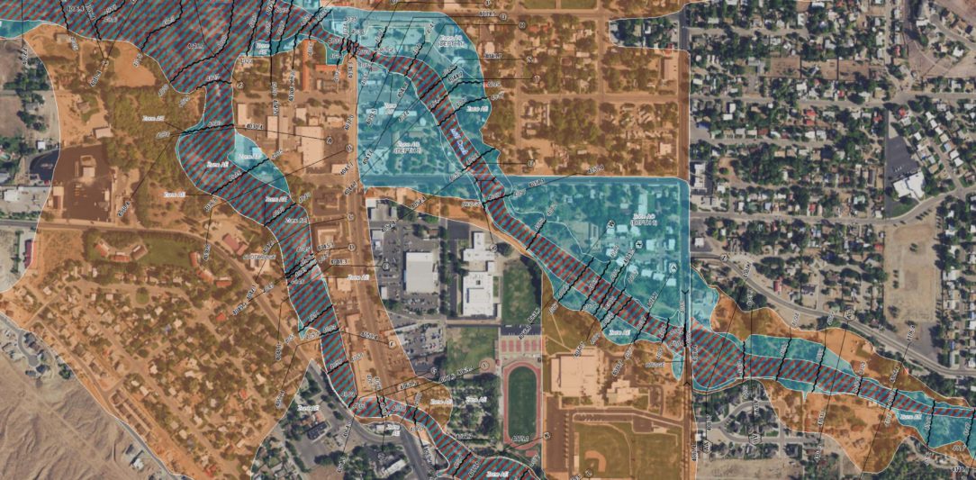
Approximate Zone A’s are areas on a FEMA Flood Insurance Rate Map (FIRM) not studied by detailed hydrologic/hydraulic methods. These areas are shown as “Zone A” without a Base Flood Elevation (BFE) identified on the FIRM or in the Flood Insurance Study (FIS). Determining the BFE in these areas can be challenging, but guidance and new technology is available to … Read More
Introducing the new Utah Risk MAP website!
floodhazards.utah.gov was designed with two types of users in mind: Risk managers and floodplain administrators who are working to lower the risk of flood damage in their communities, and Utahns interested in finding out the risk of flooding at a particular property and protecting that property from flooding damage. As you probably already know, Risk MAP is quite complex! This … Read More