

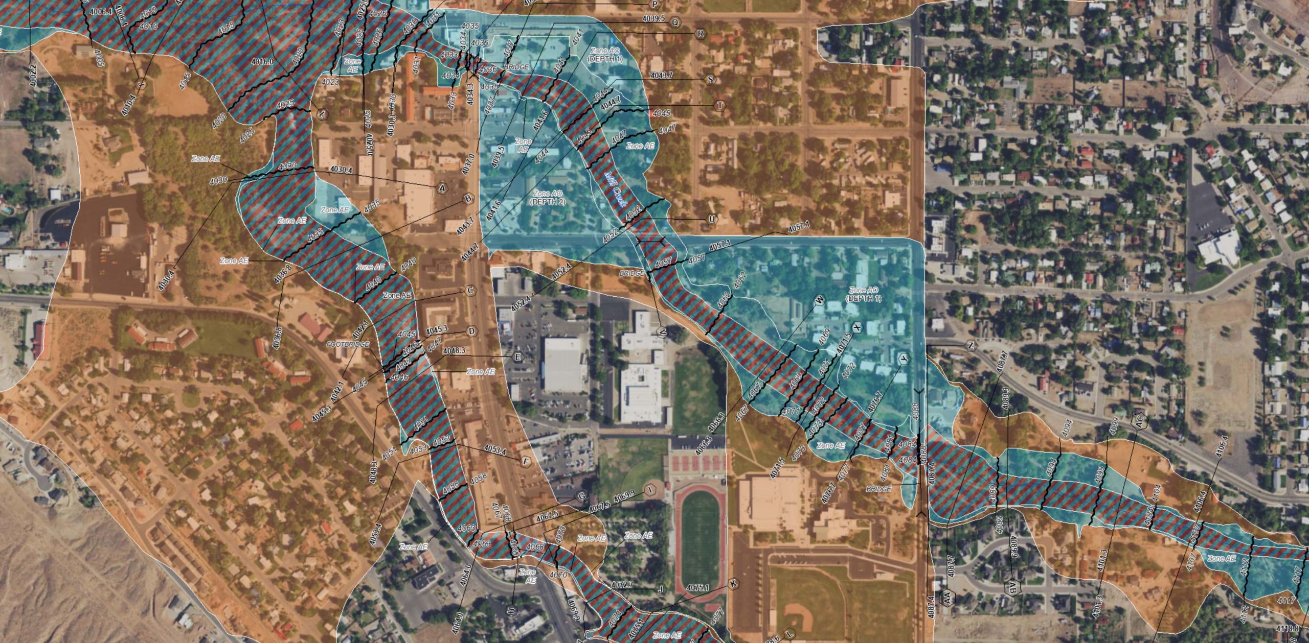
Developing a Base Flood Elevation in a Zone A
Nov. 11, 2022Approximate Zone A’s are areas on a FEMA Flood Insurance Rate Map (FIRM) not studied by detailed hydrologic/hydraulic methods. These…
- /
Introducing the new Utah Risk MAP website!
Dec. 30, 2021floodhazards.utah.gov was designed with two types of users in mind: Risk managers and floodplain administrators who are working to lower…
- /
Read about current flood and floodplain news to stay updated on active and future mapping projects, current disaster declarations, and available mitigation funding.