In Production:
Active Utah Projects
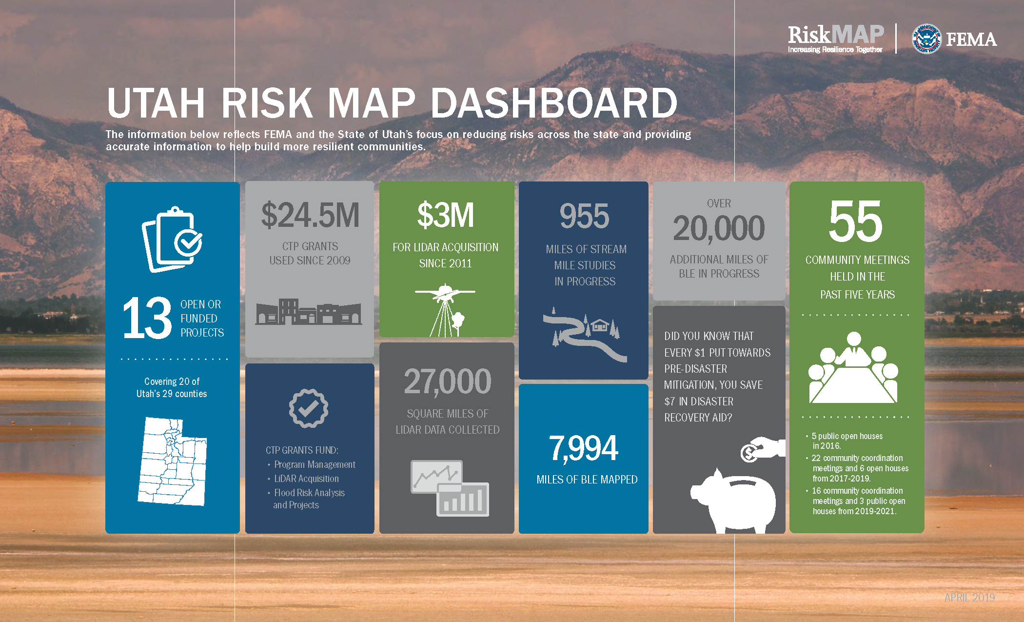
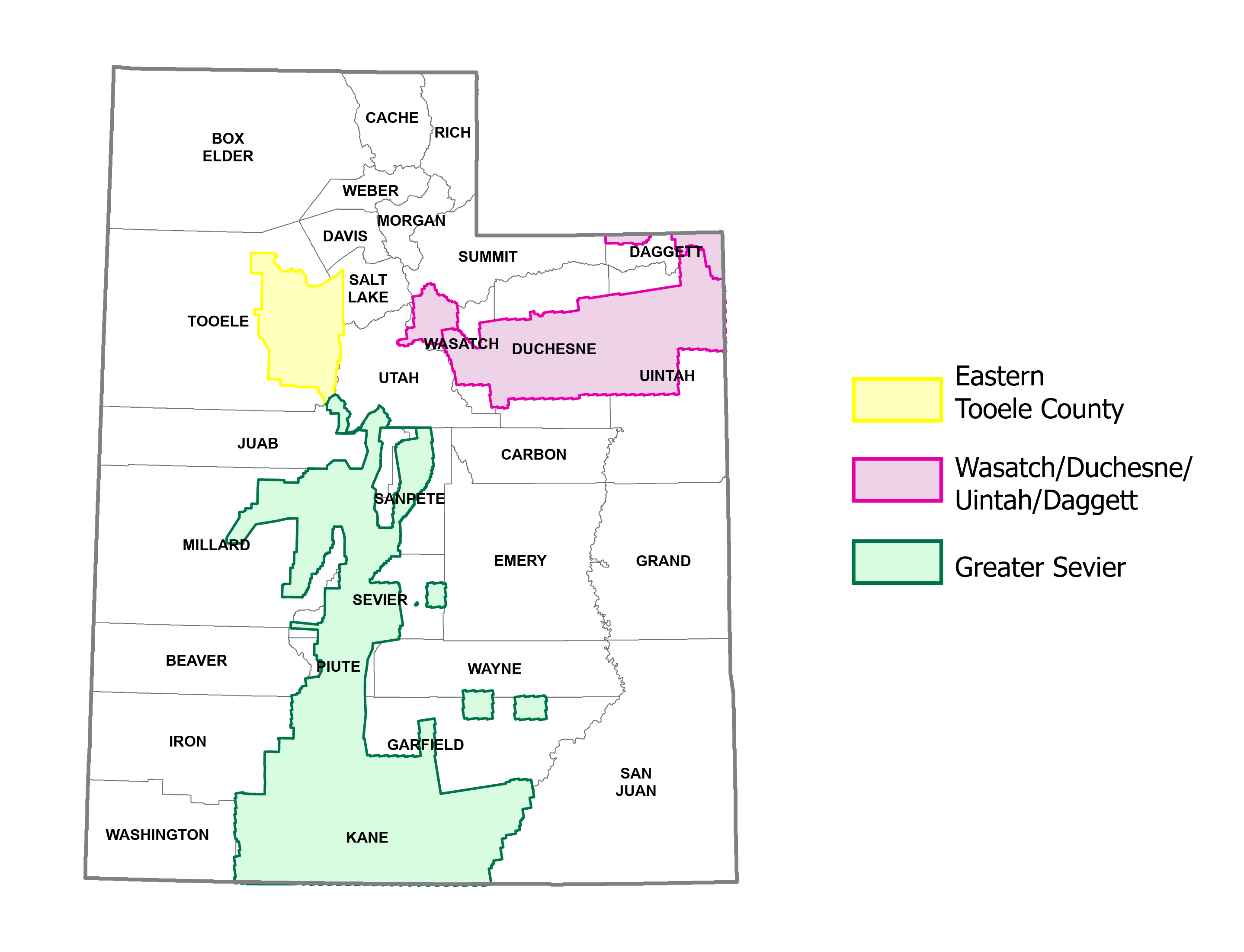
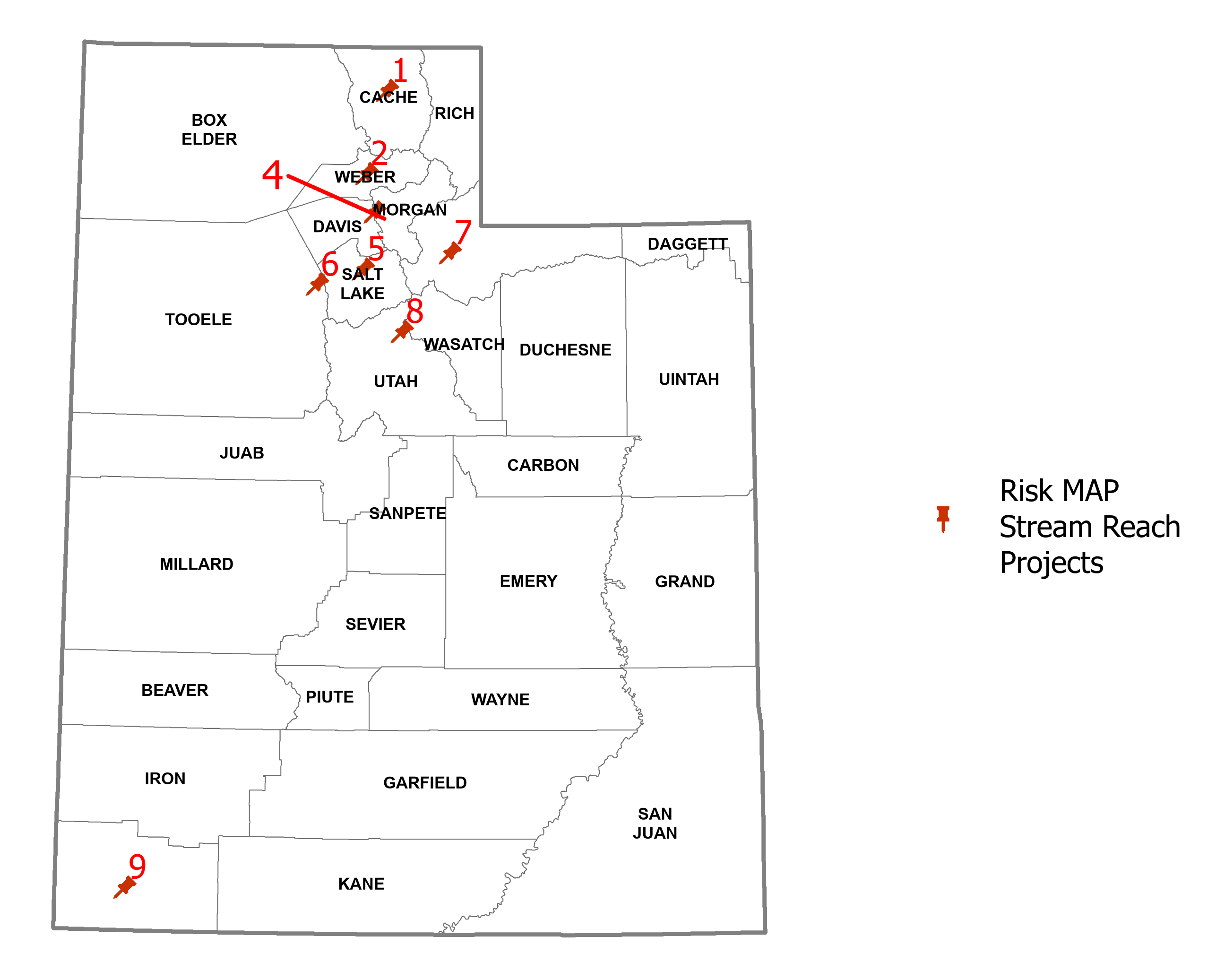
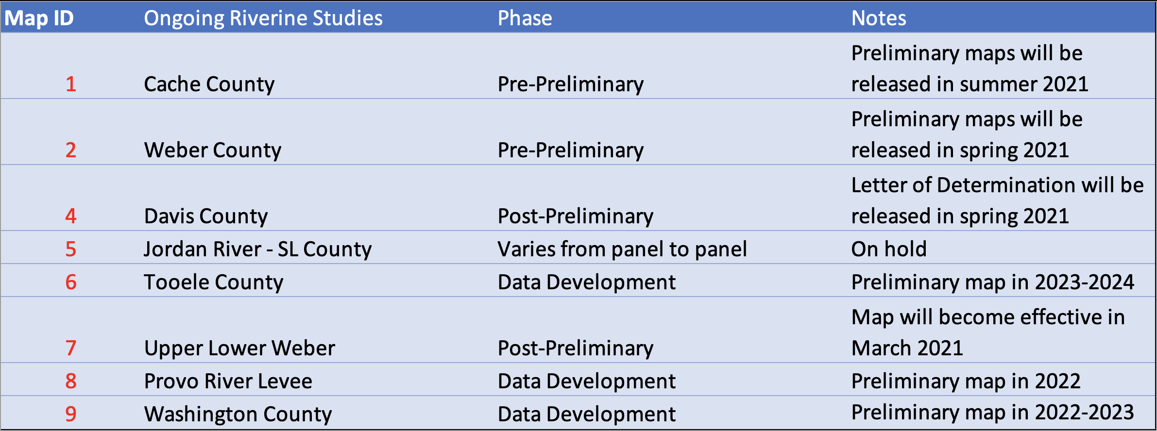
Utah's Division of Emergency Management (DEM) is a Cooperating Technical Partner for FEMA's Risk MAP program. We deliver high-quality hazard identification and risk assessment products, provide outreach support and empower communities to take action to reduce risk based on informed, multi hazard-based data and resources. Currently we have 13 active mapping projects spanning 20 counties. Eventually we hope to have up-to-date floodplain information for all populated areas of Utah.


Active Project Websites
Click on the thumbnails below to Risk MAP data and documentation for the various stages of that project.
Not all projects have websites—just those beginning in 2020 or after.
Utah's Floodplain Mapping Program Produces Three Types of Studies:
1. Base Level Engineering for Entire Watersheds
Base Level Engineering (BLE) uses an automated approach for identifying areas at 1% annual risk from riverine floods, i.e., Risk MAP "A Zones". It produces a baseline understanding of community flood risk and is recommended for sparsely populated areas where no full-scale mapping of Special Flood Hazard Areas has taken place. BLE is a cost-effective method of mapping large areas so it is often used to delineate flood risk in larger watersheds or even across entire counties. Engineers use state-of-the-art two-dimensional hydrologic and hydraulic models with LiDAR-derived elevation datasets, landcover and soils data, and precipitation data as inputs. BLE deliverables include floodplain boundaries, flood depth and water surface elevation grids.
2. Enhanced Individual Stream Studies
A more data intensive approach is recommended when delineating flood risk in populated areas where manmade structures and flood control practices play a large role in determining the behavior of water flows. As with BLE projects, data development involves a digital elevation model of the terrain, and hydrology and hydraulic modeling. In addition, survey data of culverts, bridges, diversion structures, dams, weirs, and other hydraulic structures are incorporated into the models. The Risk MAP team encourages local engineers and floodplain managers to share knowledge, data and priorities. This information is incorporated into the mapping process. The resulting flood map delineates the 1-percent-annual-chance ("100-year") floodplain, (that FEMA designates as a Special Flood Hazard Areas or SFHA); and the .02-percent-annual-chance ("500-year") floodplain. The remaining areas above the 0.2-percent-annual-chance floodplain are termed "areas of minimal flood hazard".
3. Lake Studies
Considerable flooding can occur when high lake levels are combined with strong winds that drive water and waves onshore. These large waves can temporarily reach far beyond the normal shoreline, erode the backshore and potentially damage shoreline development.
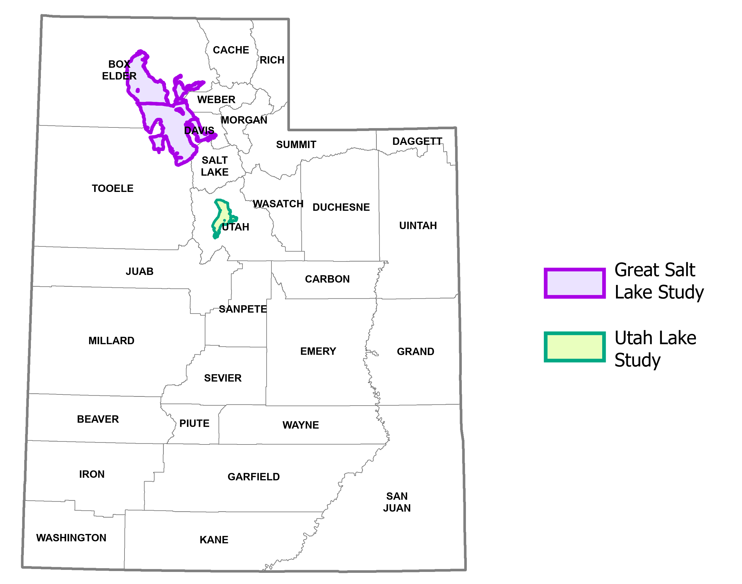
Since 1900, lake floods have occurred several times around the Great Salt Lake (1923, 1952, 1983-84) and Utah Lake (1983) causing significant damage to infrastructure. Risk MAP shoreline studies delineate "V Zones" and "Coastal A Zones" to represent areas that have at least a 1-percent-annual-chance of experiencing a flood event along with the additional hazards associated with storm-induced waves.
"Allowing communities to make informed decisions about reducing flood loss and mitigating potential damage from floods."
